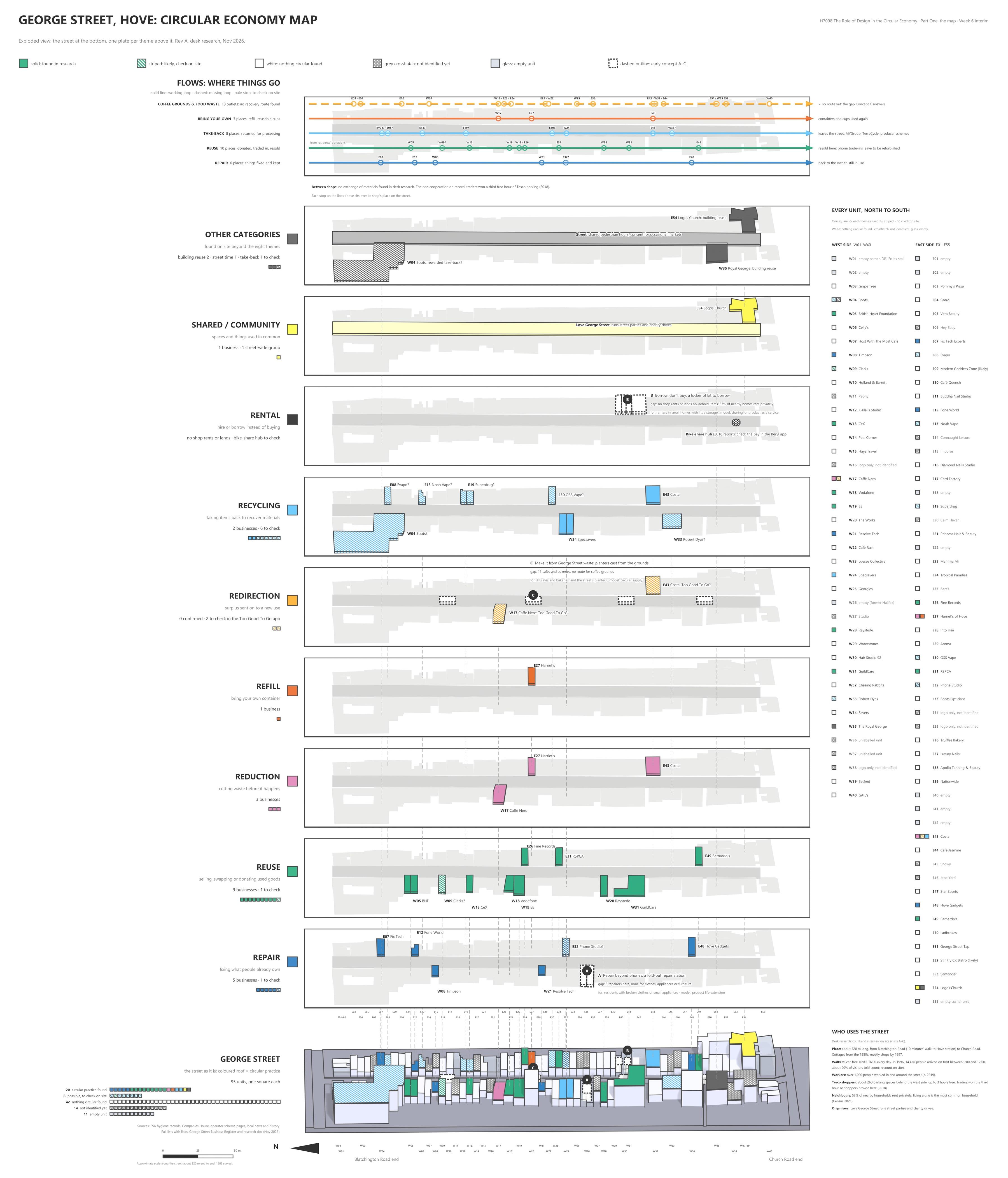
George Street, Hove: a circular economy map. Every unit on the street, set against the ways it could keep things in use.
place:george street, hove /units:92 /circular practice found:20 /possible:8 /source:desk research checked against site photos /updated:nov 2026
I mapped George Street in Hove, one unit at a time, to see where a street already keeps things in use. Each shop is set against the
circular strategies it could support: reuse, repair, recycling, reduction, refill, redirection, shared space and rental. The evidence
is desk research checked against site photos, so a solid colour is something I found and stripes are only likely.
Of the 92 units on the plan, 20 show circular practice, mostly reuse and repair. I found no rental. The
flows show where things go next: repair returns them to their owner, take-back sends them off the street, and the coffee grounds & food waste from
18 outlets have no recovery route at all.
plan
Solid colour is a practice I found. Striped is likely and needs checking on site. Select a unit for what is there, filter by theme, or
hover a flow to see which shops it passes through.
west side↑ north · blatchington road endeast side
← north · blatchington road endeast side above · west side belowsouth · church road end →
↓ south · church road end
select a unit to see what is there. 92 units · 20 with circular practice found · 8 possible · 41 nothing found · 10 empty · 13 not identified
circular practice found
possible, check on site
nothing circular found
not identified yet
empty unit
flows: where things go
each ring marks a shop's place along the street, from the north end · solid line: a working loop · dashed: a missing loop · dashed ring: to check on site · hover or tap a row to light up its shops on the plan
every unit, north to south
west side
east side
the map, exploded
one plate per theme above the street as it is: repair, reuse, reduction, refill, redirection, recycling, rental, shared, other